

Stories you may like
Cartographer
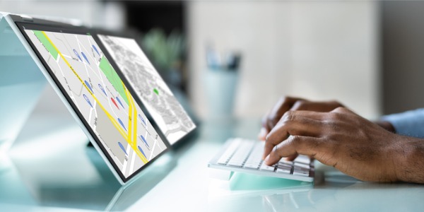
A cartographer specializes in the creation, design, and production of maps. Their role is to gather geographic data, interpret it, and transform it into accurate and visually appealing representations of the Earth's surface or specific regions. Cartographers use various techniques and tools to capture and analyze geographic information, including satellite imagery, aerial photographs, GPS data, and surveying measurements.
Cartographers possess expertise in geospatial data analysis, map projection, symbolization, and data visualization. They apply principles of cartography, geography, and geodesy to accurately represent spatial relationships, terrain features, and other geographical phenomena on maps. In addition to their technical skills, cartographers also have a deep understanding of the intended audience and purpose of the map, ensuring that the map effectively communicates information to its users. With advancements in technology, cartographers now often work with Geographic Information Systems (GIS) software to create digital maps and interactive visualizations, allowing users to explore and analyze spatial data in dynamic ways.
The role of a cartographer is essential in providing accurate and visually appealing representations of the Earth's surface, enabling individuals, organizations, and governments to understand and navigate the world around them.
Duties and Responsibilities
Cartographers have a range of duties and responsibilities, which include:
- Data Collection and Analysis: Cartographers gather and acquire geographic data from various sources, such as satellite imagery, aerial photographs, field surveys, and remote sensing technologies. They evaluate the quality, accuracy, and reliability of data sources, ensuring that the collected data is suitable for map creation. Cartographers analyze and interpret geographic data to extract relevant information and identify spatial patterns, relationships, and trends. They use geographic information systems (GIS) software to manage, manipulate, and analyze data sets, enabling them to make informed decisions during map creation.
- Map Design and Creation: Cartographers are responsible for designing and creating maps that effectively communicate geographic information. They determine the purpose and intended audience of the map to guide its design. This involves selecting appropriate map scales, projections, and symbols to accurately represent the spatial features and attributes of the area being mapped. Cartographers apply principles of cartography, such as generalization, classification, and symbolization, to ensure that the map is visually clear, aesthetically pleasing, and informative. They use specialized software and tools to create and edit maps, incorporating layers of data, labels, legends, and other necessary elements.
- Geospatial Analysis: Cartographers perform geospatial analysis to extract meaningful insights from geographic data. This includes tasks such as spatial modeling, spatial statistics, and spatial analysis techniques. By applying these methods, cartographers can identify spatial relationships, analyze patterns, and make informed decisions based on the data. Geospatial analysis helps in understanding geographic phenomena, identifying areas of interest, and supporting decision-making processes.
- Map Maintenance and Updates: Cartographers are responsible for maintaining and updating maps to ensure their accuracy and relevance. They monitor changes in geographic features and update maps accordingly. This involves incorporating new data, removing outdated information, and adjusting map elements as needed. Cartographers also collaborate with other professionals, such as surveyors, geographers, and urban planners, to gather additional data and ensure the maps reflect the latest information.
- Communication and Collaboration: Cartographers often work closely with professionals from various disciplines, such as urban planning, environmental science, and engineering. They collaborate to incorporate specialized data and address specific project requirements. Cartographers also communicate with clients, stakeholders, and the general public to understand their map needs, provide information, and address inquiries or feedback.
- Research and Development: Cartographers stay updated with advancements in technology, data collection methods, and mapping techniques. They continuously explore new tools, software, and methodologies to improve map design and production processes. Cartographers also conduct research and contribute to the development of new cartographic methods, visualizations, and geospatial technologies.
Types of Cartographers
Cartographers can specialize in various areas of map creation and analysis. Many cartographers possess a combination of skills and may work in multiple areas depending on the project requirements and their professional interests.
- Topographic Cartographers: Topographic cartographers create maps that depict the physical features of the Earth's surface. They collect and analyze elevation data, contour lines, and terrain information to accurately represent the landscape on maps. Their work involves collaborating with surveyors and geodesists to ensure precise measurements.
- Geodetic Cartographers: Geodetic cartographers focus on establishing and maintaining accurate geodetic reference systems. They use advanced surveying techniques and satellite-based positioning systems to determine precise locations and coordinates. Their work contributes to the development and improvement of geodetic datums and coordinate systems used in mapping.
- GIS Cartographers: GIS cartographers work with geographic information systems software to manage, analyze, and visualize geospatial data. They create digital maps, perform spatial analyses, and generate thematic maps using multiple data sources. GIS cartographers support decision-making and spatial analysis in fields such as urban planning and environmental management.
- Remote Sensing Cartographers: Remote sensing cartographers utilize data from satellite imagery and aerial photographs. They process, interpret, and analyze remote sensing data to extract information about land cover, vegetation, and other Earth's surface features. Their work contributes to environmental monitoring, disaster management, and natural resource assessment.
- Nautical Cartographers: Nautical cartographers specialize in creating navigational charts for marine and coastal areas. They integrate data related to bathymetry, tides, currents, and coastal features to produce accurate charts for safe navigation. Nautical cartographers adhere to international standards and guidelines to ensure the reliability of their charts.
What is the workplace of a Cartographer like?
The workplace of a cartographer can vary depending on the specific industry and job requirements. Cartographers may work in a variety of settings, including government agencies, private companies, research institutions, and consulting firms.
In a government agency, such as a national mapping agency or a department of natural resources, cartographers may work in offices dedicated to map production. They collaborate with surveyors, geographers, and other professionals to gather and analyze geographic data. These offices are equipped with specialized software, computers, and tools for data processing, map design, and quality control.
Private companies, such as GIS service providers or engineering firms, may employ cartographers in office settings. They work on projects related to land development, urban planning, environmental assessment, or transportation. These workplaces often have a combination of office spaces, meeting rooms, and design studios where cartographers collaborate with multidisciplinary teams.
Fieldwork is also a part of the cartographer's job, especially for those involved in surveying or remote sensing. Cartographers may conduct field surveys, collect data using GPS devices, or capture aerial imagery through drone flights. This aspect of their work may involve spending time outdoors in various terrains and weather conditions.
Cartographers frequently use specialized software and technology, such as geographic information systems (GIS), remote sensing tools, and image processing software. They also work with a range of geographic datasets, including satellite imagery, aerial photographs, and survey data. Additionally, cartographers may have access to geographic databases, map libraries, and reference materials to support their work.
Collaboration and communication are essential aspects of a cartographer's workplace. They often collaborate with other professionals, such as surveyors, geographers, environmental scientists, and urban planners. Effective communication is crucial for understanding project requirements, coordinating data collection efforts, and presenting map products to clients or stakeholders.
How to become a Cartographer
To become a cartographer in the United States, you typically need a combination of education, skills, and practical experience. Here is a detailed overview of the steps involved in pursuing a career as a cartographer:
- Obtain a Bachelor's Degree: Earn a Bachelor's Degree in Cartography, Geography, Geomatics, Surveying Engineering, or a related field. Look for programs accredited by the National Geospatial-Intelligence Agency (NGA) or those that offer courses in GIS, remote sensing, and cartographic principles. Coursework may include map design, spatial analysis, data collection, GIS software, and geodetic concepts.
- Gain Technical Skills: Develop proficiency in using Geographic Information Systems (GIS) software, remote sensing tools, and digital mapping technologies. Acquire knowledge of cartographic principles, map projection systems, and spatial analysis techniques. Familiarize yourself with data collection methods, such as GPS and aerial imagery interpretation.
- Gain Fieldwork Experience: Seek opportunities to gain hands-on experience in the field. Look for internships, co-op programs, or entry-level positions that involve data collection, map production, or GIS analysis. This experience will enhance your practical skills and provide valuable insights into real-world cartographic applications.
- Pursue Professional Certifications: Consider obtaining professional certifications to demonstrate your expertise and enhance your career prospects (see below).
- Continued Education and Professional Development: Stay updated with advancements in cartography, GIS, and remote sensing by attending workshops, conferences, and webinars. Join professional associations like the International Cartographic Association (ICA), National States Geographic Information Council (NSGIC), or the American Association of Geographers (AAG). These organizations provide access to networking opportunities, publications, and resources for professional development.
- Consider Advanced Degrees: Pursuing a master's degree or higher in cartography, GIS, or a related field can provide advanced knowledge and open doors to specialized positions or research opportunities. It may also enhance your chances of advancing into leadership roles within the field.
- Build a Portfolio: Assemble a portfolio showcasing your best cartographic projects, including maps you have created, GIS analyses you have conducted, and any other relevant work samples. A strong portfolio will demonstrate your skills, creativity, and ability to communicate complex information effectively.
- Job Search and Networking: Search for job openings in government agencies, private companies, research institutions, and consulting firms that require cartographic expertise. Utilize professional networking platforms, attend industry conferences, and connect with professionals in the field to expand your job opportunities.
Certifications
There are several certifications available for cartographers that can enhance their professional credentials and demonstrate their expertise in the field.
- Certified Cartographic Technician (CCT): Offered by the American Society for Photogrammetry and Remote Sensing (ASPRS), the CCT certification is designed for individuals with a strong foundation in cartographic principles and techniques. It validates their knowledge and skills in map design, data compilation, symbolization, and cartographic production.
- Geographic Information Systems Professional (GISP): The GIS Certification Institute (GISCI) offers the GISP certification, which recognizes professionals skilled in geospatial technologies, including cartography. This certification validates expertise in GIS software, data analysis, map production, and spatial data management.
- Certified Mapping Scientist - Remote Sensing (CMS-RS): Also provided by ASPRS, the CMS-RS certification is aimed at professionals specializing in remote sensing and its applications in cartography. It demonstrates proficiency in satellite imagery interpretation, digital image processing, and the integration of remote sensing data into cartographic products.
- Esri Technical Certification: Esri, a leading GIS software provider, offers a range of technical certifications that include cartographic components. These certifications validate proficiency in using Esri software, such as ArcGIS, for cartographic design, map production, spatial analysis, and data visualization.
Associations
There are several professional associations in the United States that cater to the needs of cartographers and provide resources, networking opportunities, and professional development.
- International Cartographic Association (ICA): The ICA is the world's leading organization for cartography and brings together cartographers and professionals involved in mapping from around the globe. It promotes the exchange of knowledge, research, and best practices in cartography.
- North American Cartographic Information Society (NACIS): NACIS is a professional society for cartographers, map librarians, GIS specialists, and others interested in the field of cartography. It organizes an annual conference, publishes the journal "Cartographic Perspectives," and provides a platform for networking and collaboration.
- American Society for Photogrammetry and Remote Sensing (ASPRS): While primarily focused on photogrammetry and remote sensing, ASPRS also caters to the cartographic community. It offers resources, publications, and conferences that cover various aspects of mapping, including cartographic design and production.
- National States Geographic Information Council (NSGIC): NSGIC is an organization that represents state and regional Geographic Information System (GIS) professionals, including cartographers. It facilitates collaboration, information exchange, and advocacy for GIS and mapping-related issues at the state and national levels.
- Society of Cartographers (SOC): The Society of Cartographers is a UK-based organization, but it has members from around the world, including the United States. The SOC promotes the art, science, and practice of cartography and hosts conferences, workshops, and competitions.
- Cartography and Geographic Information Society (CaGIS): CaGIS is an organization dedicated to advancing the field of cartography and geographic information science. It sponsors conferences, publishes the journal "Cartography and Geographic Information Science," and provides networking opportunities for cartographers and GIS professionals.
Workshops, Conferences, and Webinars
There are several workshops, conferences, and webinars held in the United States that cater to cartographers and provide valuable learning and networking opportunities.
- Esri User Conference: Organized by Esri, a leading provider of GIS software, the Esri User Conference is a major gathering of GIS professionals, including cartographers. The event offers workshops, presentations, and networking opportunities to learn about the latest developments in GIS technology, cartographic design, and spatial analysis.
- North American Cartographic Information Society (NACIS) Annual Meeting: NACIS holds an annual meeting that brings together cartographers, map librarians, and GIS specialists. The conference features presentations, workshops, and discussions on various cartographic topics, including map design, data visualization, and new technologies.
- International Cartographic Conference (ICC): The ICC is a biennial conference organized by the International Cartographic Association (ICA). While the conference location varies each year, it provides a platform for cartographers worldwide to present their research, share insights, and discuss emerging trends in cartography.
- American Association of Geographers (AAG) Annual Meeting: The AAG Annual Meeting is a premier event for geographers, including cartographers, GIS professionals, and spatial scientists. It features a wide range of sessions, workshops, and presentations covering diverse topics related to mapping, spatial analysis, and geospatial technologies.
- State and Regional GIS User Group Meetings: Many states and regions have their own GIS user group meetings and conferences that include cartographic-focused sessions. These events provide opportunities to learn about local mapping initiatives, share experiences, and network with professionals in the area.
- Online Webinars and Training: Numerous organizations, including Esri, NACIS, and professional associations, offer online webinars and training sessions specifically tailored for cartographers. These webinars cover topics such as map design principles, advanced cartographic techniques, GIS software tutorials, and emerging trends in the field.





User's Comments
No comments there.